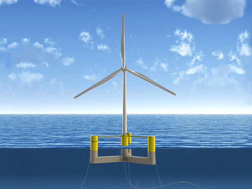
The state of Maine submitted a lease application on Friday to the U.S. Bureau of Ocean Energy Management for 9,696 acres in federal waters in the Gulf of Maine to build a floating offshore wind research array.
In its application, the state said it plans to install no more than 12 turbines on the site, which is 40 miles from Portland. Cape Small, north of Portland, is the nearest mainland point from the site at 29 miles.
Among the top priorities for the project is evaluating how floating technologies interact with Maine’s billion-dollar fishing industry, of which lobstering is a mainstay.
“Fundamentally, I believe that offshore wind and Maine’s fishing industry can not only coexist but can help us build a stronger economy and a brighter, more sustainable future for Maine people,” Gov. Janet Mills said in a statement.
A consortium will oversee research activities and release open-source results from the project, according to the application. Mills signed a law (LD 1619) in July that established the consortium, which must include three representatives of the state’s lobstering industry, two representatives of the state’s commercial fishing industry and the state’s commissioner of marine resources.
The law also established a moratorium on OSW development in state waters in the Gulf of Maine, where 75% of the state’s lobsters are harvested, according to the application.
“The state of Maine engaged hundreds of individuals, which resulted in selection of a proposed lease area in a location with limited lobster activity and minimal groundfish activity,” the application said.
In June, Mills signed the Act to Encourage Research to Support the Maine Offshore Wind Industry (LD 336), which directs state regulators to enter a long-term contract for a 144-MW floating wind research array. The law allows a state utility to secure the contract with New England Aqua Ventus, the joint venture behind the 11-MW floating wind pilot that will feature the University of Maine’s VolturnUS concrete semi-submersible hull.
The pilot will be sited at UMaine’s deep-water OSW test site 3 miles southwest of Monhegan Island in the Gulf of Maine. The island is 23 miles from the proposed lease site for the research array, which also will feature the VolturnUS hull.
Research activities would take place throughout the planned project development process, which Maine estimated in its application would take eight years. The array, according to the application, is a critical element of the state’s current OSW roadmap initiative.
Maine received $2 million from the U.S. Economic Development Administration to create the roadmap, which will outline the best way to build the state’s OSW potential without harming the fishing industry. The final roadmap is due in December 2022. (See Roadmap Initiative Set to Hone Maine’s OSW Goal.)
Four working groups must deliver initial recommendations for the map to the lead advisory committee by the end of this year.
A fisheries working group met on Wednesday to consider a draft proposal of pre-construction monitoring priorities for the research array for inclusion in the roadmap. The group proposed researchers conduct a survey of the amount and distribution of marine life in and around the lease area. In addition, the group said an oceanographic data buoy on the array location would provide environmental condition data and allow researchers to monitor marine life. Other recommendations included continued seafloor mapping and a survey of existing commercial and recreational fishing activity.
The fisheries working group will meet again in mid-October.


