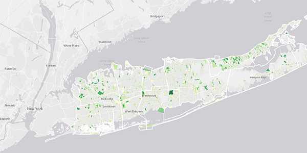
Long Island can support 19.5 GW of new, low-impact solar development, according to a three-year study led by the Nature Conservancy and Defenders of Wildlife.
The potential solar capacity would produce more electricity than Long Island needs, Jessica Price, landscape conservation ecologist for the Nature Conservancy, said Friday in a webinar on the study’s findings. “We are not advocating that all that solar needs to be built,” she said. “But it illustrates that there are ample low-impact sites available.”
The findings are part of the Long Island Solar Roadmap, an effort to advance mid- to large-scale solar power on the island. Low-impact sites, as identified in the study, are rooftops, parking lots and ground-mounted solar on disturbed lands.
The study found that 80% of the viable low-impact sites are on private property. That finding points “to the importance of private property owners as part of the solution” to building more renewable energy, Price said. “It can’t be a government-only solution.”
The full report will be released at solarroadmap.org in early March.
Market Barriers
Grid upgrades needed to increase hosting capacity for distributed generation and enable high levels of interconnection will drive up solar project costs, Price said.
The study recommends addressing high project costs by lowering soft costs, such as permitting. Price said data provided in the study also can be used to target grid upgrades to areas with high potential for solar development.
An additional barrier to solar development is limited access to incentives, according to the study. “There is an absence of resources available to those 80% of private property owners that would actually be the host or owners of these systems,” Price said.
The study suggests that new incentives be created to encourage low-impact siting.
“Rather than being location agnostic, we have some recommendations for how different players can encourage low-impact versus high-impact siting,” Price said.
Interactive Map
The Roadmap project included the development of an interactive web-based map that identifies low-impact solar sites on Long Island. The interactive map is available at solarroadmap.org/maps.
The map allows users to click on parcels and see the solar potential by technology type. One parcel along the southern coast in Islip, for example, has the potential to host about 10.3 MW of solar, consisting of 1 to 1.3 MW on rooftops and 9 MW on parking lots. Another parcel at Long Island MacArthur Airport could host 223.5 MW of ground-mounted solar.


