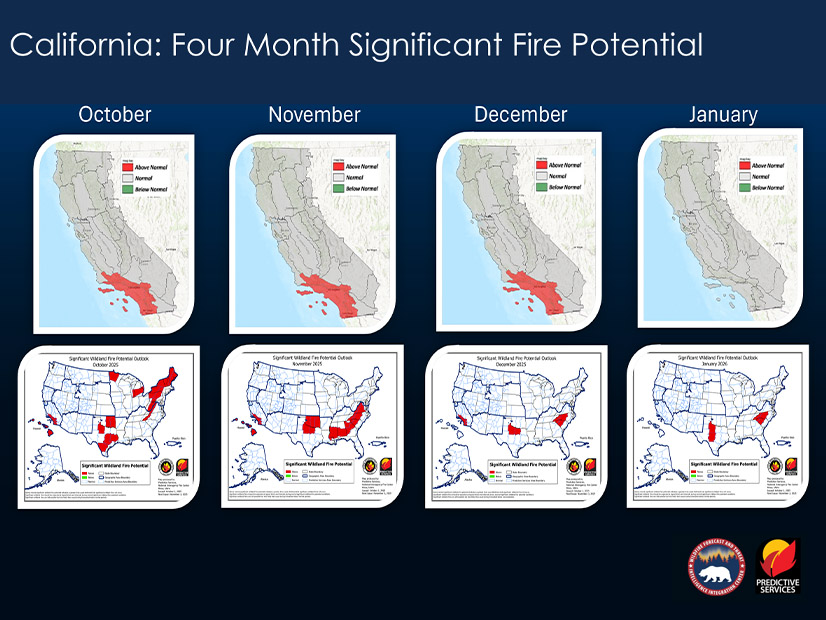
Southern California faces an above-normal chance of a significant wildfire in the coming months, less than one year after a set of deadly fires burned thousands of acres and structures in the Los Angeles region.
“Southern California is now under moderate to severe drought, with just one little area of extreme drought over the lower desert,” Jeff Fuentes, assistant chief of the California Department of Forestry and Fire Protection (Cal Fire), said in an Oct. 2 winter readiness workshop hosted by CAISO’s RC West. “Santa Ana wind events will warm atmospheric conditions and drive above normal fire potential during October through December.”
The South Coast region of Southern California shows the highest fire potential in the state because precipitation likely will be well below normal there from now through January, Fuentes said.
About 10 months ago, a group of massive wildfires ignited in Southern California, including the Eaton Fire, which burned about 14,000 acres, resulting in 19 deaths and 22 missing people, and destroyed more than 9,000 structures.
Rainstorms are expected in the region in late December or early January 2026. After these storms, “we get back to normal fire potential statewide,” Fuentes said.
“[But] this doesn’t mean the wildfire season is over. All it takes is some dry events, some dry conditions and offshore winds … to kind of create those dangerous fire conditions,” Fuentes added.
So far this year, more than 7,000 fires in the state have burned about 500,000 acres — a slight increase in fires compared with 2024. About 1,000 more fires this year have ignited compared with the five-year average.
Water Outlook
As for precipitation, California ended the 2024/25 water year at about 91% of the normal precipitation level, said Jessica Stewart, CAISO senior energy meteorologist. California’s water year runs from Oct. 1 to Sept. 30.
For the new water year, there is about a 71% chance of La Niña through fall and about a 54% chance through February. The stronger the La Niña signal, the lower the chance California has to see above-average snowfall, Stewart said.
La Niña events historically have resulted in “more dry than wet years, but research also suggests that even as the climate grows hotter and drier overall, the precipitation that California does receive will arrive in stronger storms, increasing the risk from flooding,” the California Department of Water Resources (CDWR) said in a Sept. 30 press release.
“There is no such thing as a normal water year in California,” CDWR Director Karla Nemeth said in the release. “Just in the past two winters, deceptively average rain and snowfall totals statewide masked the extremely dry conditions in Southern California that contributed to devastating fires as well as flood events across the state from powerful atmospheric river events.”
In the coming months, the precipitation forecast is below average from the San Francisco Bay Area to the southern border of California, Stewart said. However, the ongoing drought in California and the West worsened between 2024 and 2025. Extreme flooding is a critical concern this year due to a warmer atmosphere, which causes an increased amount of moisture and more powerful storms, DWR said in the release.


